

SCARCE UNFOLDED (NEVER BOUND) GEOLOGICAL MAP BY J.S. HENSLOW, 1822
SCARCE UNFOLDED (NEVER BOUND) GEOLOGICAL MAP BY J.S. HENSLOW, 1822
HENSLOW, John Stevens (1796–1861)
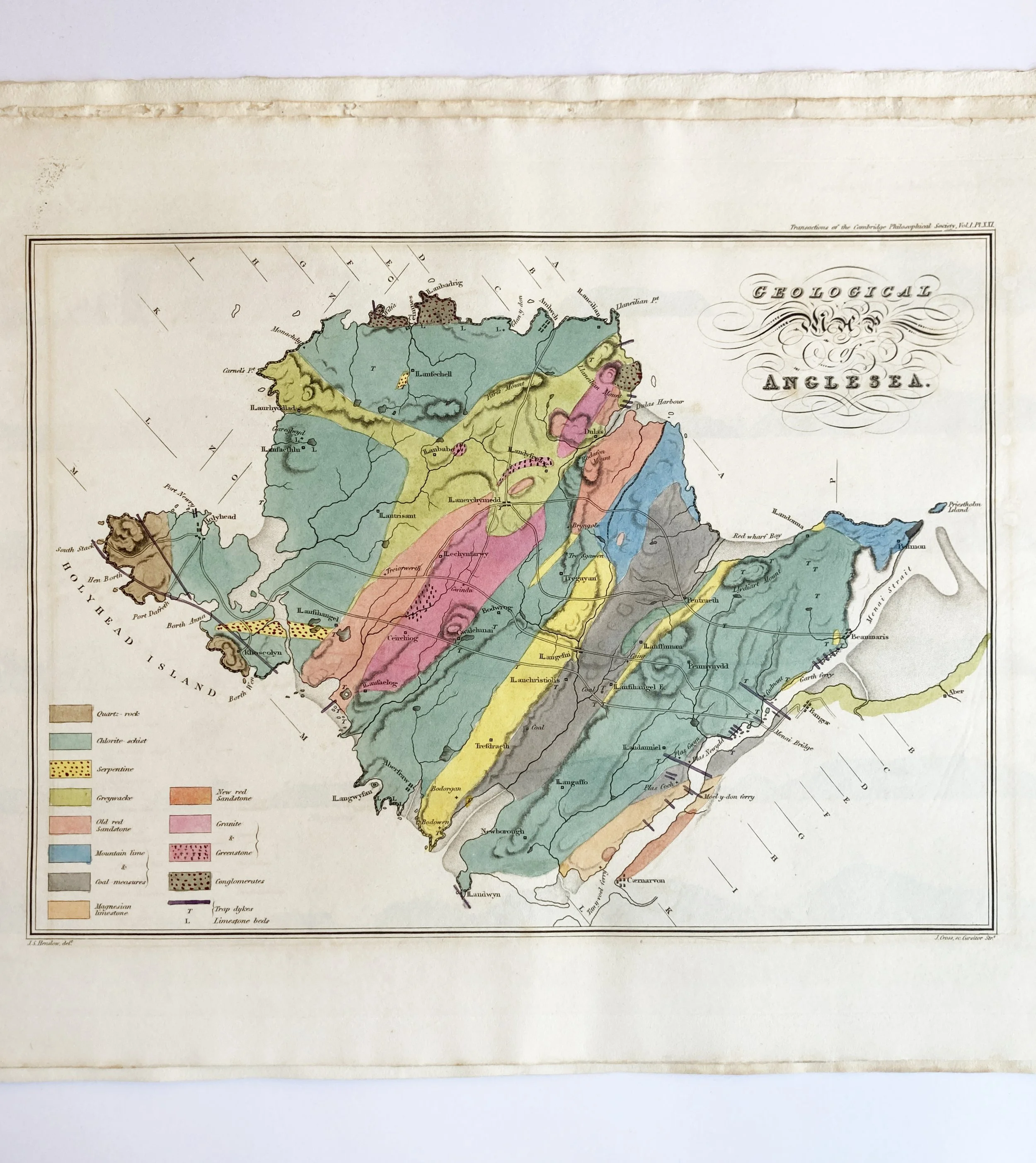
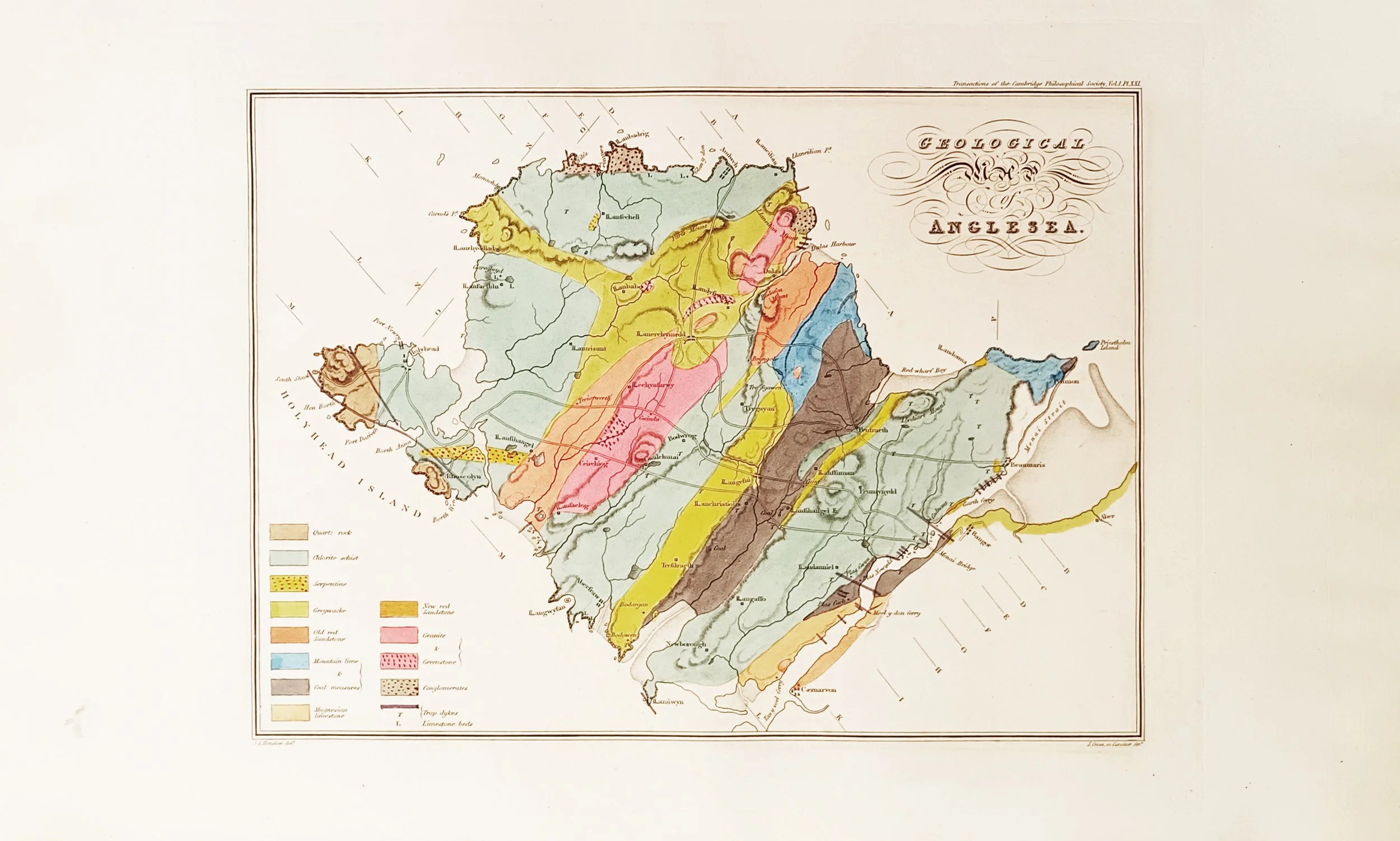
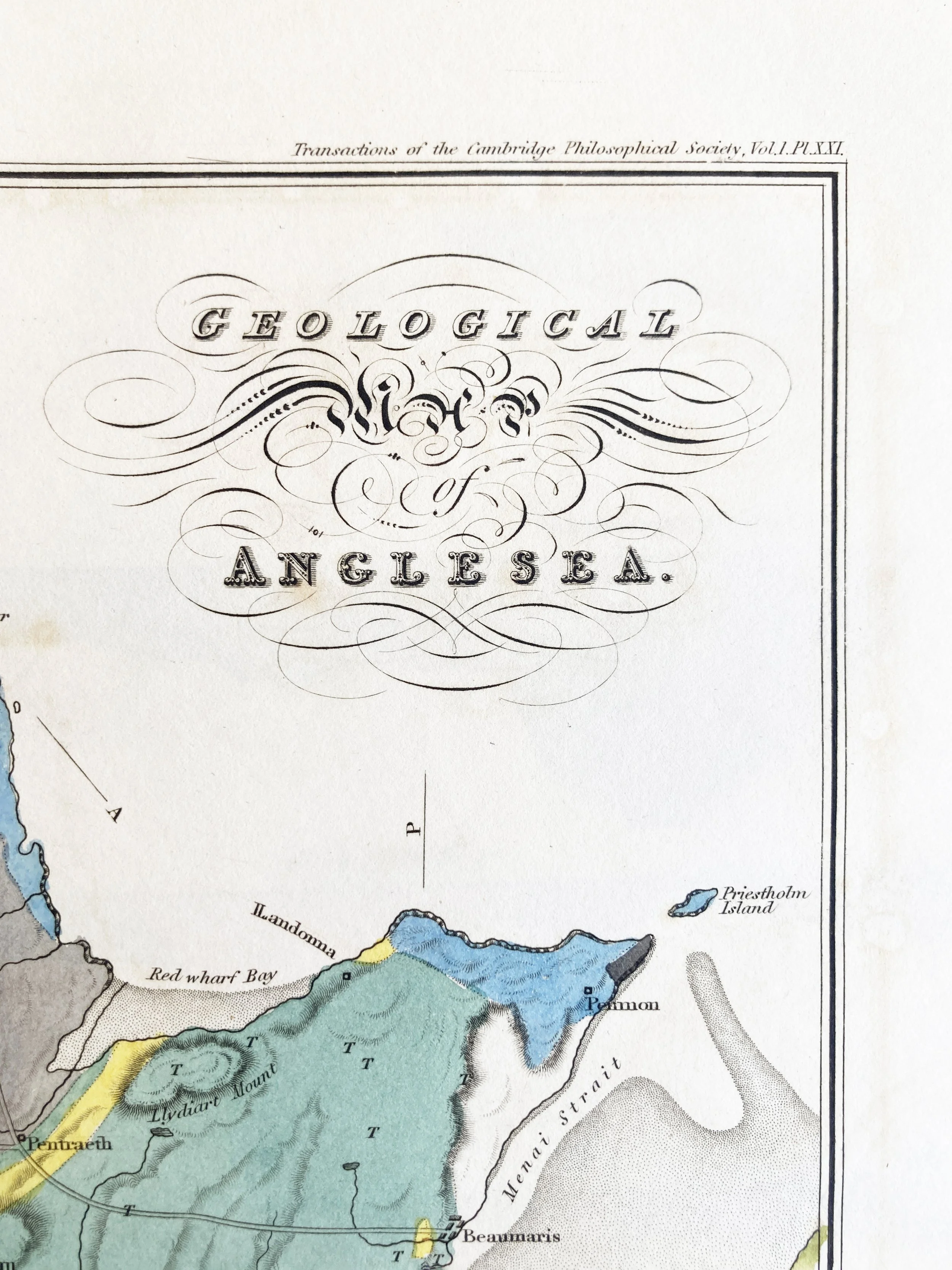
Geological Map of Anglesea
Cambridge: Cambridge Philosophical Society, 1822
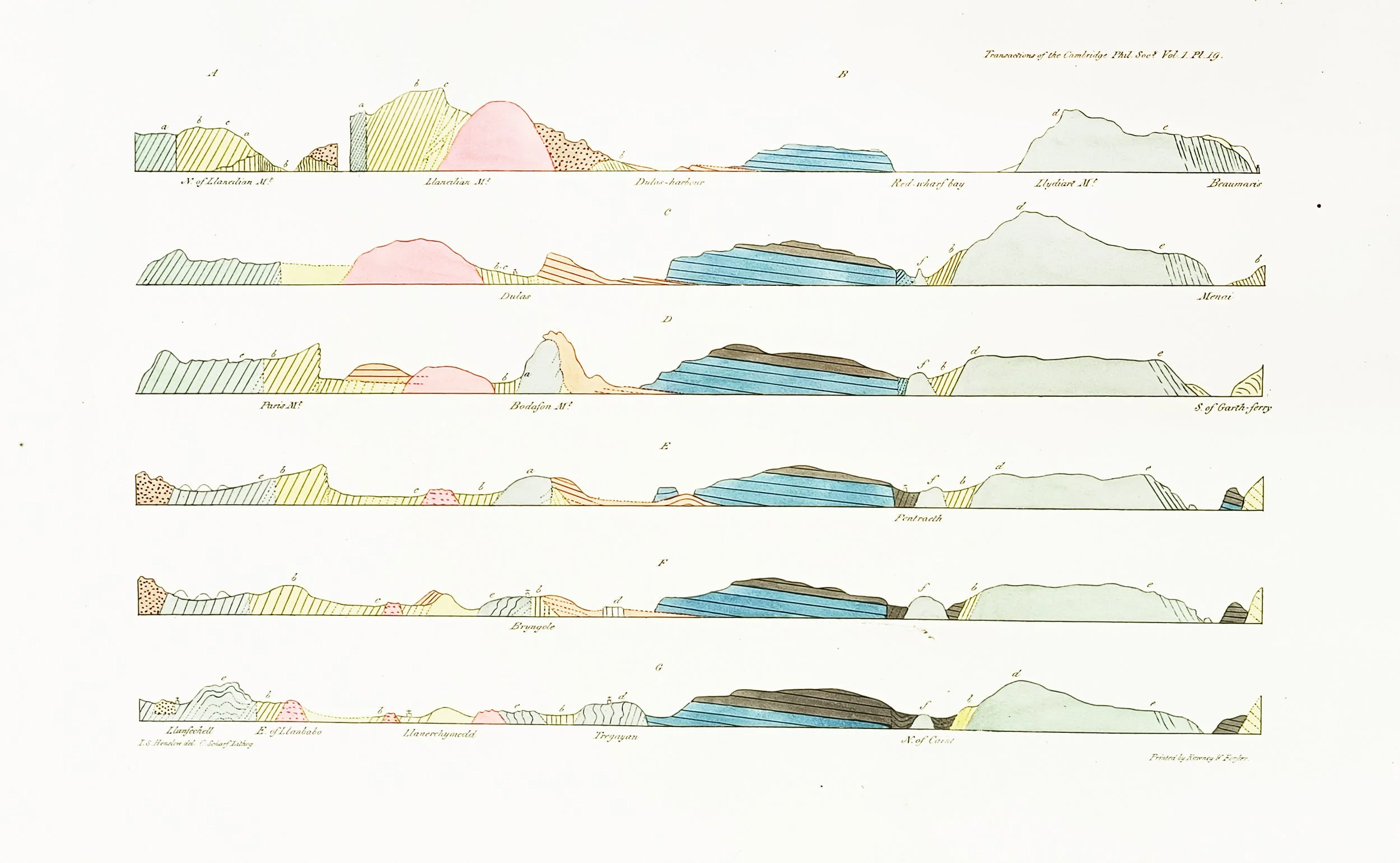
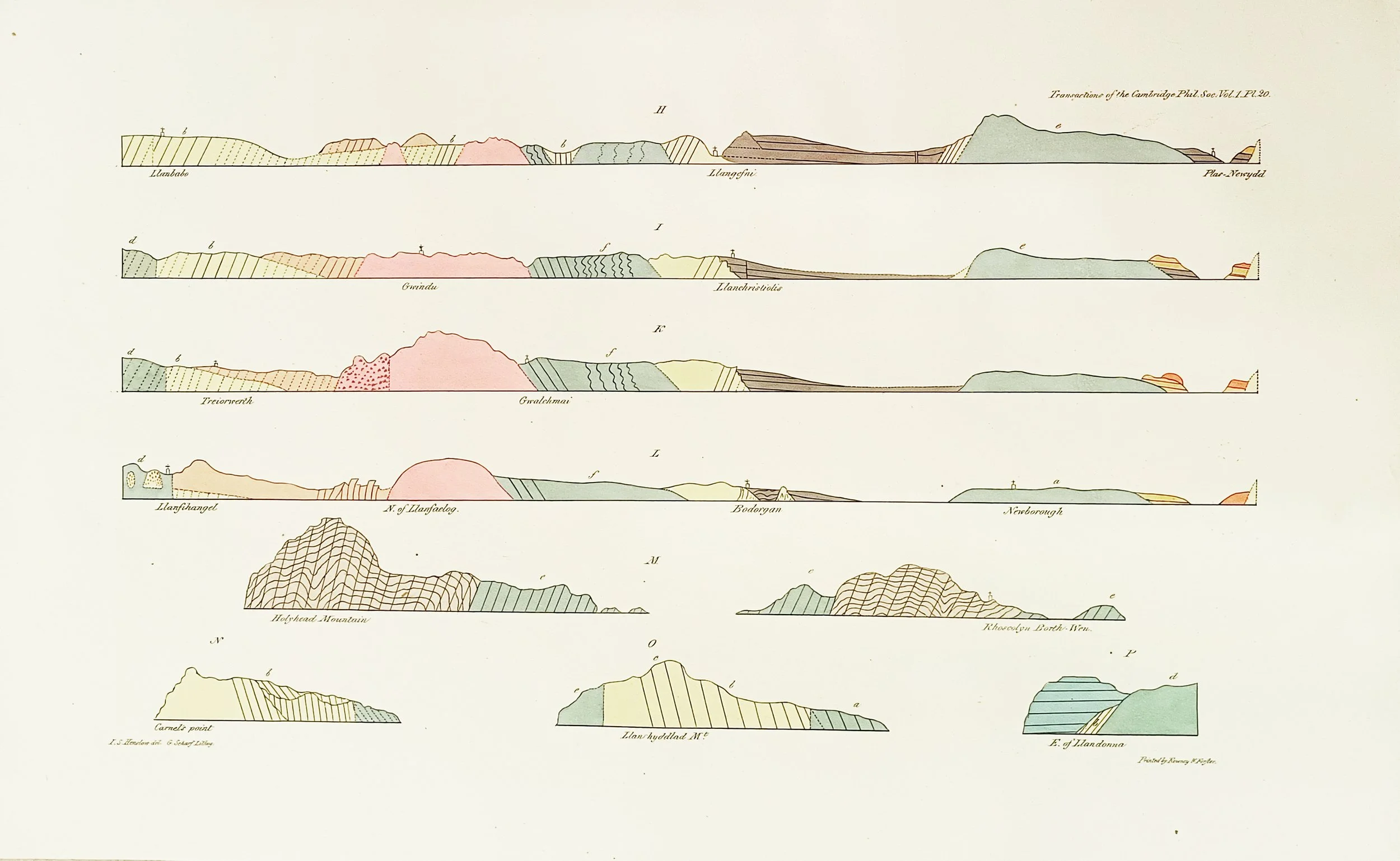
285 x 445mm, hand-coloured, together with two plates of parallel sections from the nw to se of the island, also hand-coloured, (3)
A stunning hand-coloured geological map by John Stevens Henslow, printed to accompany his first published scientific paper – but here offered in its pristine unfolded state, having been retained by the Cambridge Philosophical Society as part of a collection of unissued archival materials.
Although Henslow was to become most famous as a botanist, like his pupil Charles Darwin he began his scientific career in geology. His fieldwork in on Anglesey initiated the scientific study of the island:
The history of geological study on Anglesey goes back to John Henslow (1796–1861) even though geologists first think of Edward Greenly when they hear of Anglesey. Henslow was educated at St John’s College, Cambridge where he graduated in 1818, the year in which Adam Sedgwick became Woodwardian Professor of Geology. He developed a passion for geology and accompanied Sedgwick on fieldwork. He arrived on Anglesey to investigate aspects of the island’s geology, recognising the belts of ‘chloritic schists’ and other exotic rocks, and published his observations in the first volume of the Transactions of the Cambridge Philosophical Society in 1822. (Geomon website)
Charles Darwin took a copy of Henslow’s paper with him on the Beagle Voyage, and used the map as a model for his own geological studies of the Falkland Islands.
Near fine condition; a few very small chips to the edges.
Provenance: Cambridge Philosophical Society, retained from the time of publication until 2024.