

Charles V. Monin, Nouvelle Carte Gastronomique [1830]

Charles V. Monin, Nouvelle Carte Gastronomique [1830]
MONIN, Charles V. (active 1830–1880)
Nouvelle Carte Gastronomique, Routière & Administrative de la France
Paris: Chez Troude […] Passage Valois), n.d. [1830]
Essay
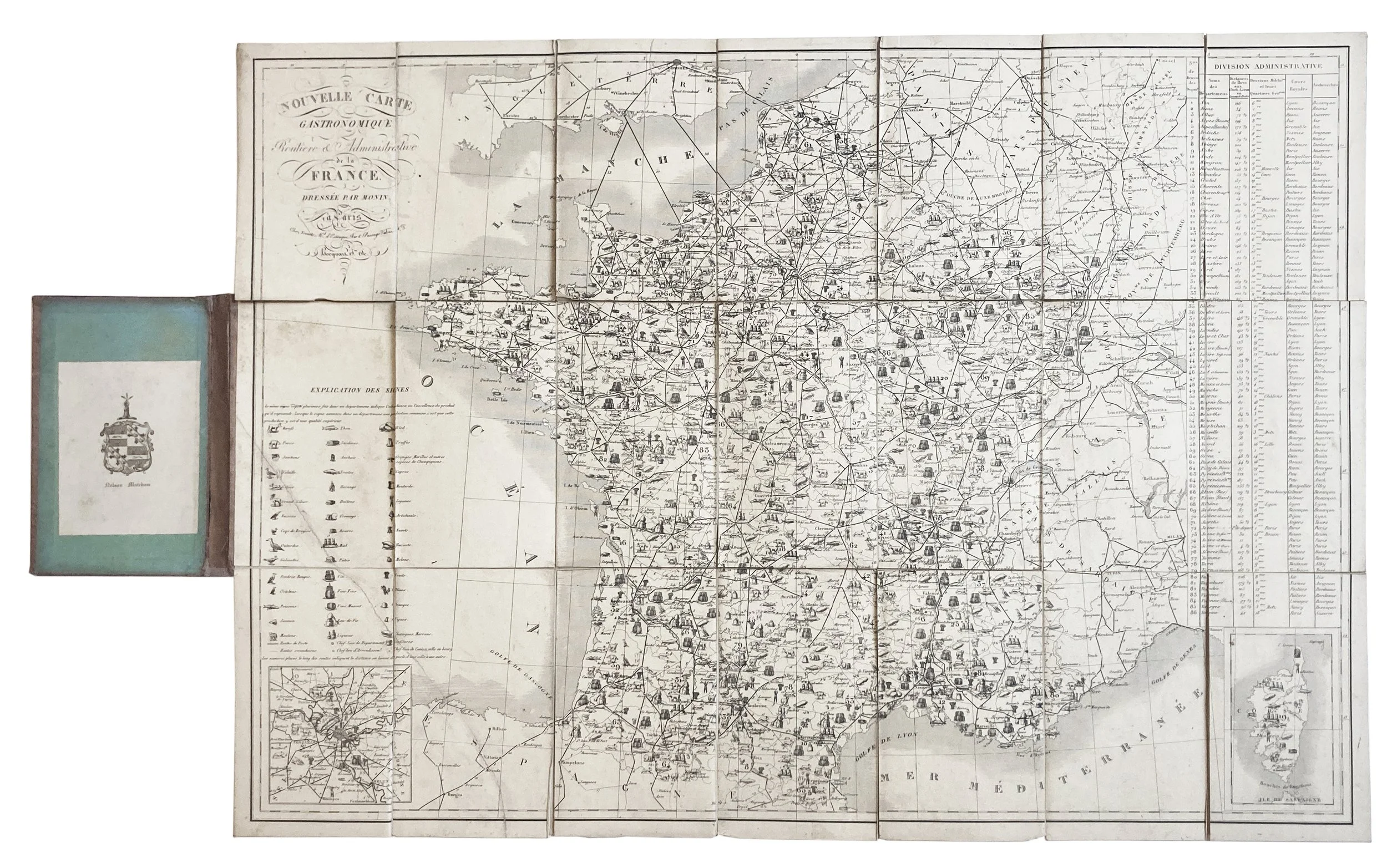
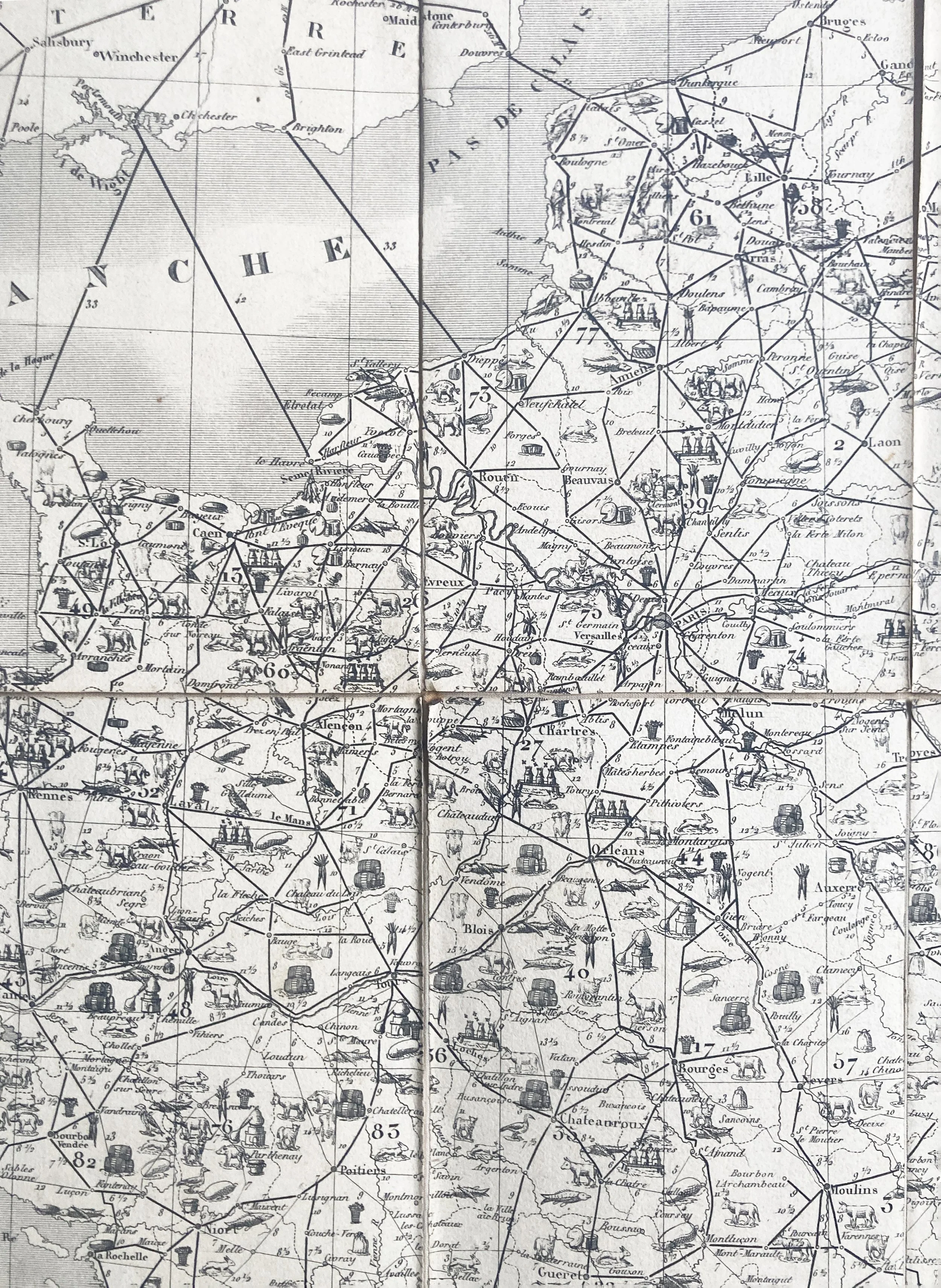
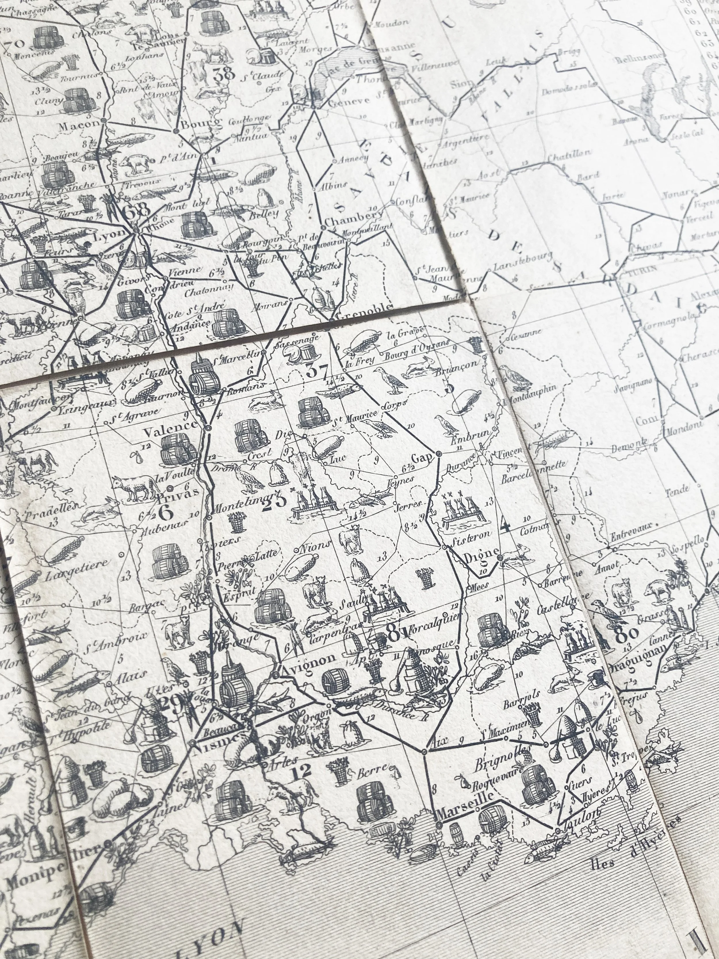
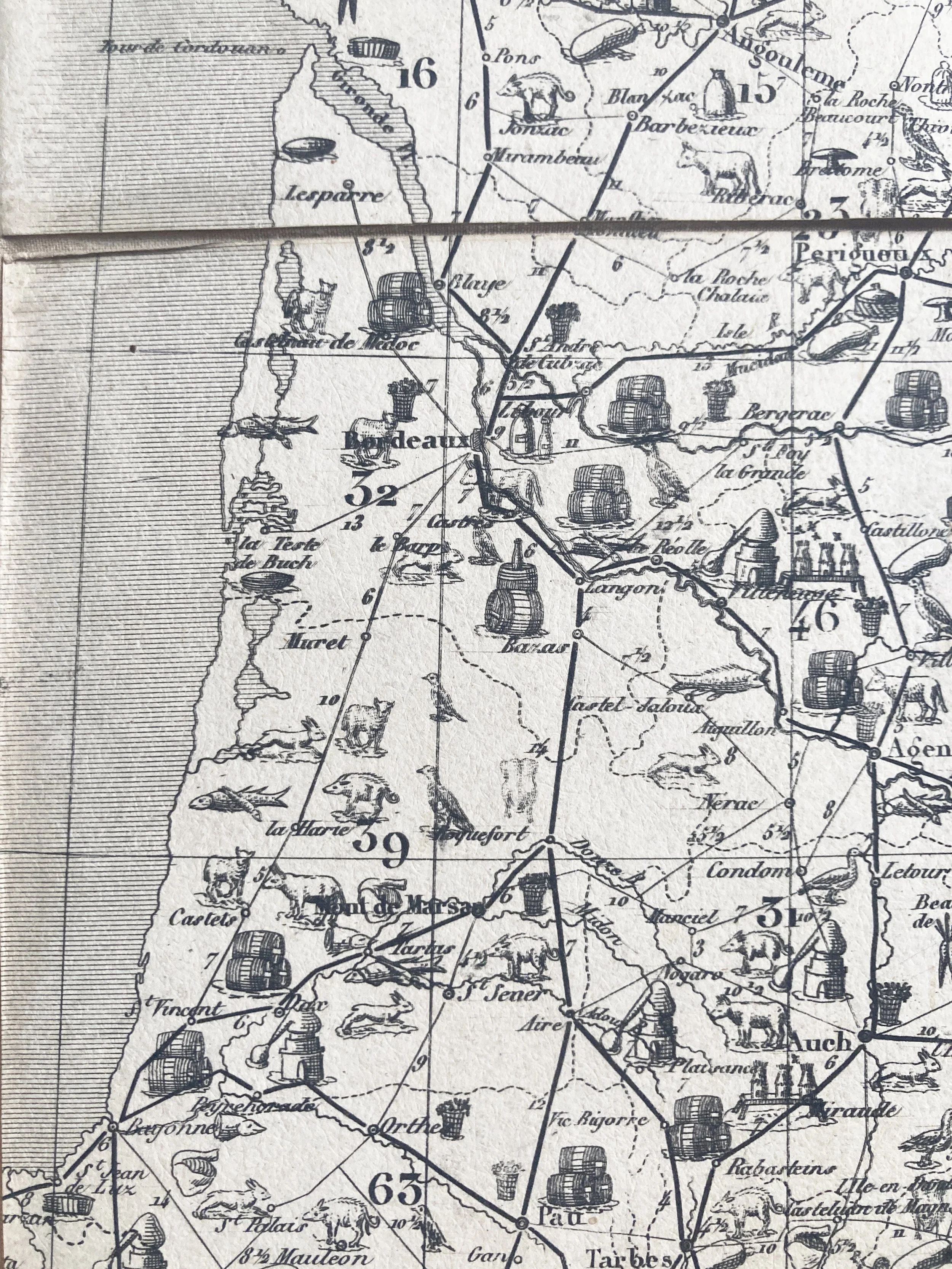
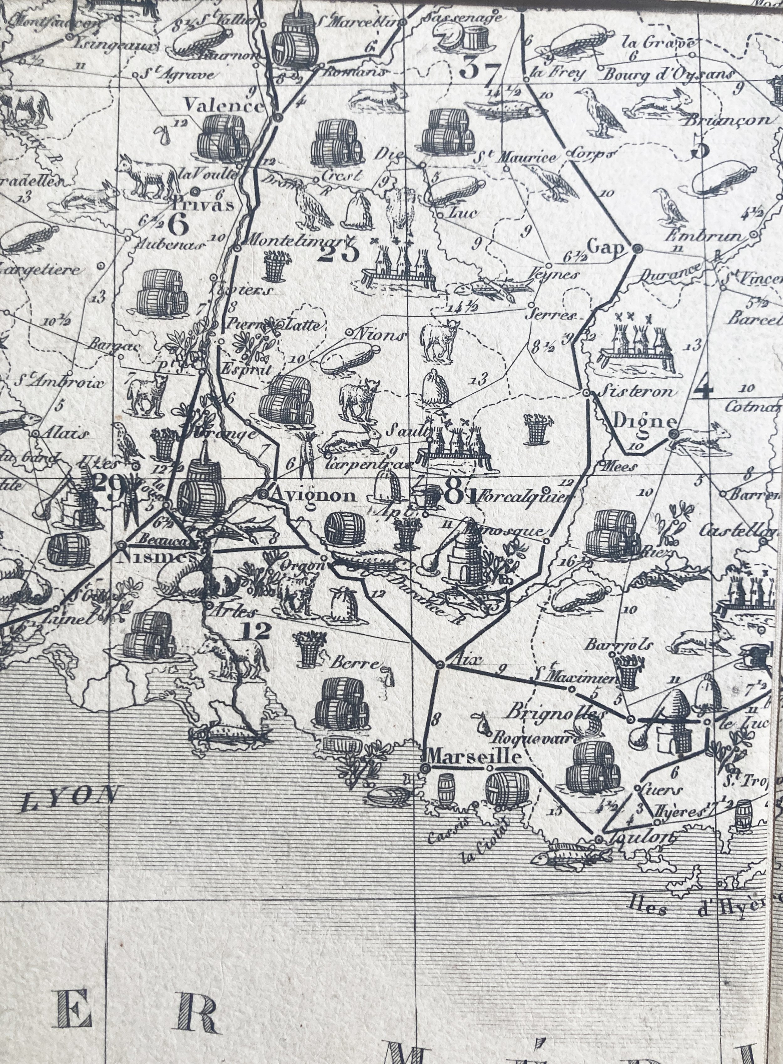
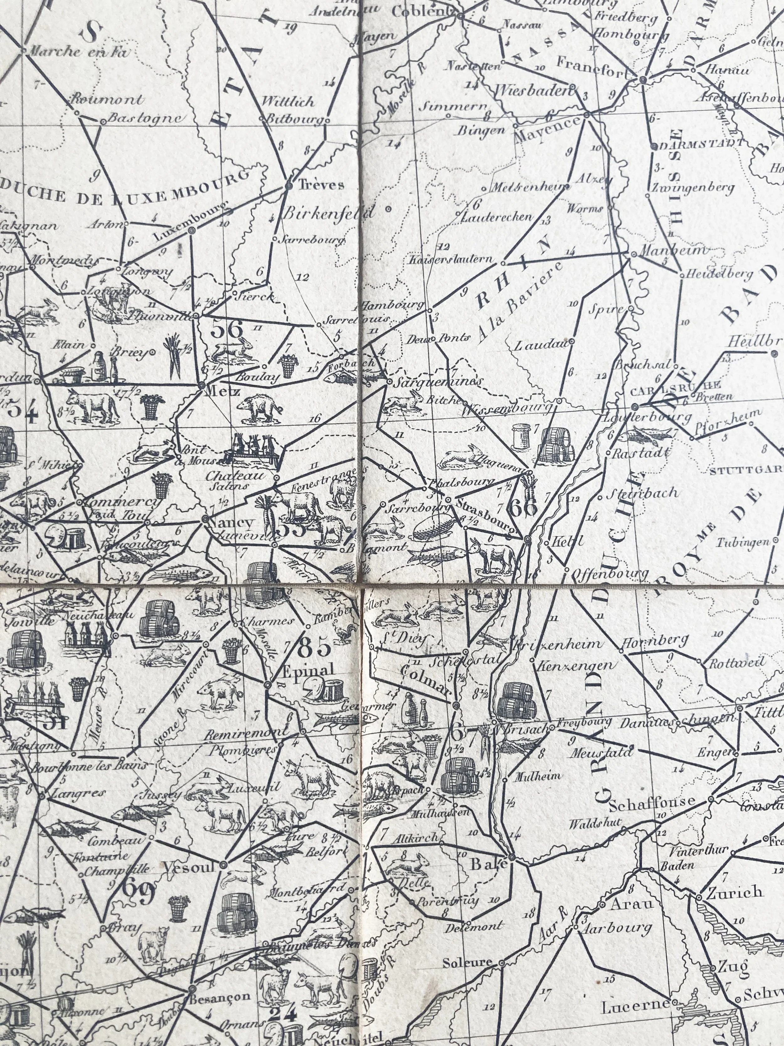
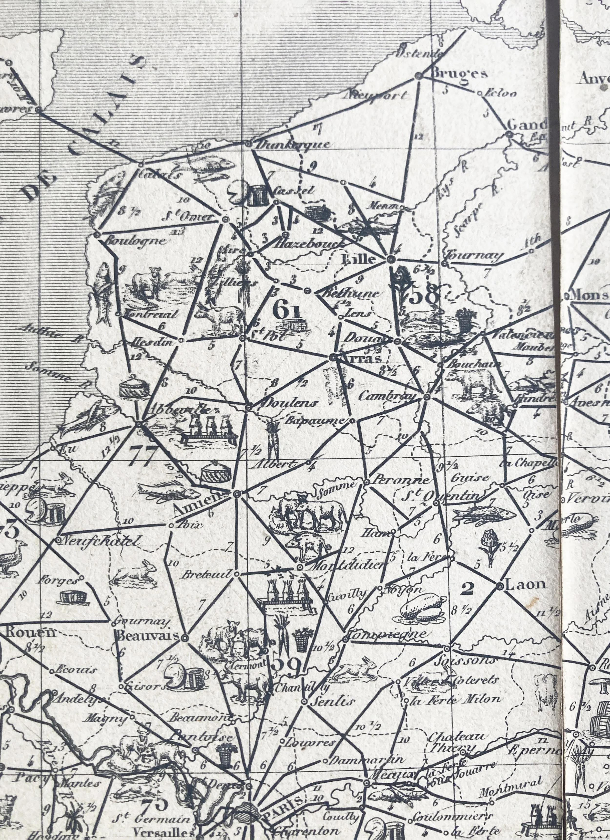
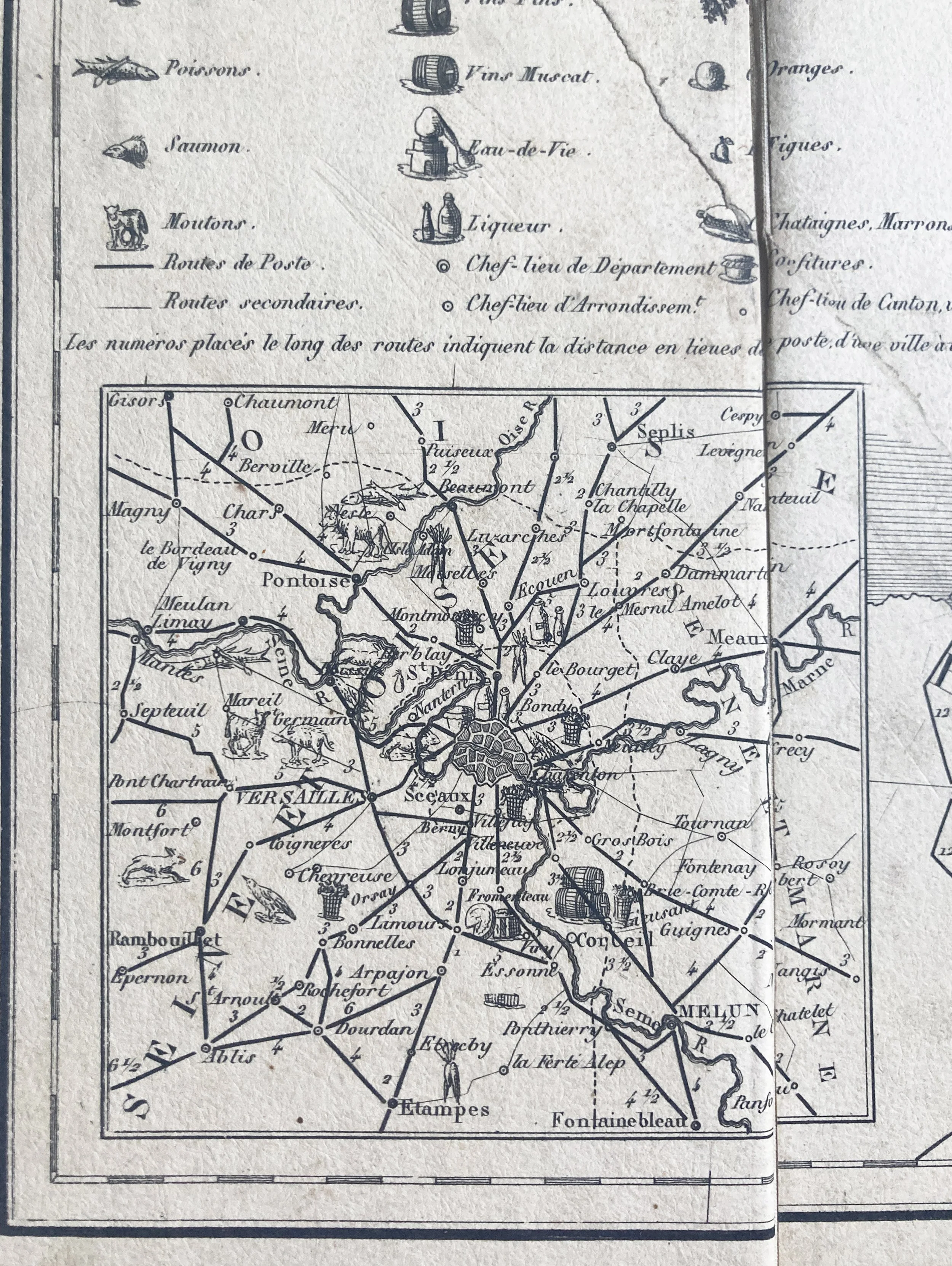
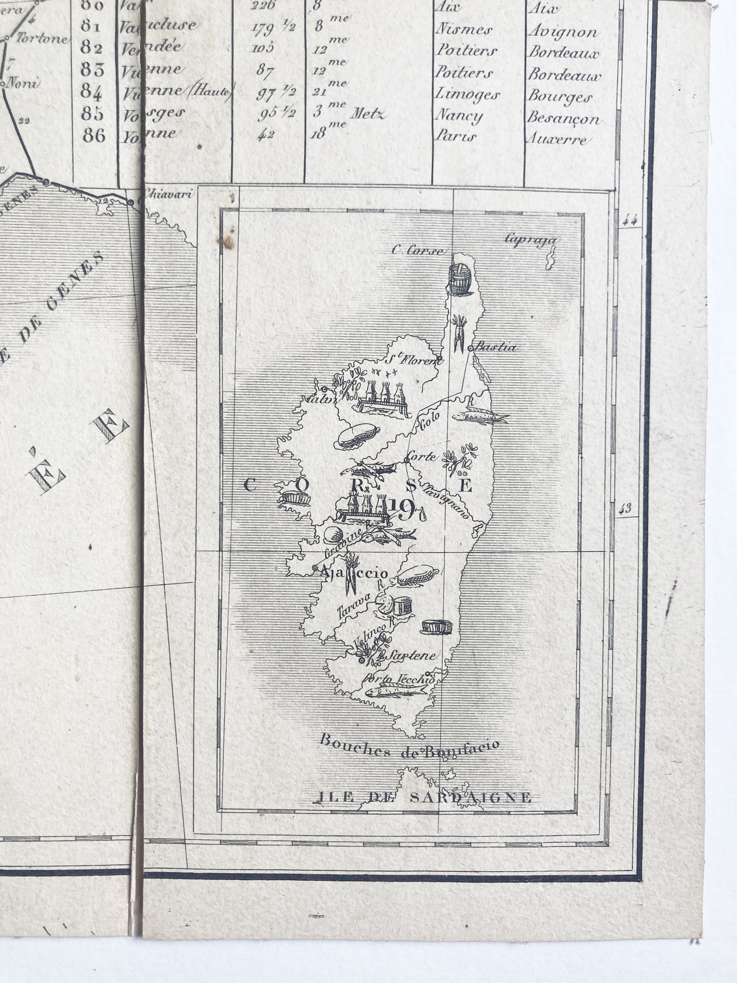
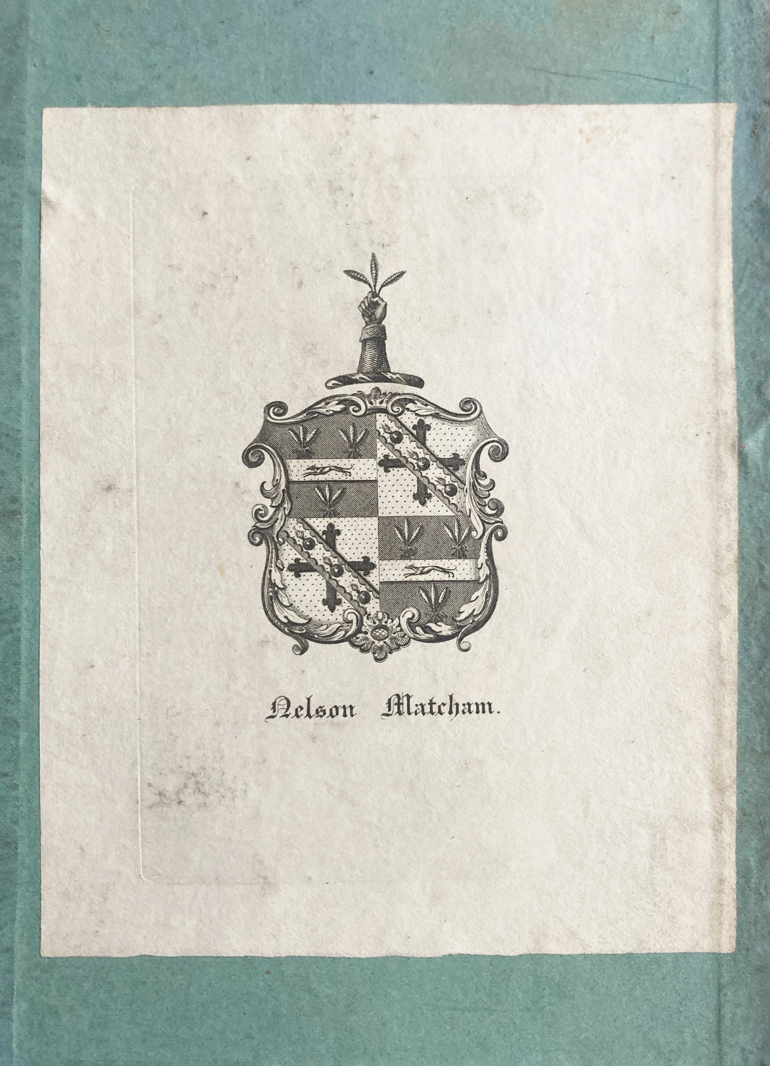
Folding engraved map (536 x 753mm), dissected and mounted on linen, showing France, part of Spain, Italy, Switzerland, the German Lands, Belgium, and Southern England, Corsica inset to bottom right, the region around Paris to the bottom left, table headed ‘Division Administrative’ to upper right, primary and secondary postal routes indicated by black lines, regional produce indicated by 46 vignettes, cartouche to upper left, no scale given (edges worn and some grubbiness to the left-hand side of the map, closed tear affecting 3 panels, occasional evidence of double-striking in the printing); folding to octavo (189 x 121mm) in original patterned purple cloth (spine a little weak; residue to the spine and about 15mm of each cover). Provenance: Nelson Matcham (1811–1886), bookplate to inside cover (Matcham, a barrister, was Admiral Lord Nelson’s nephew).
A rare and ingenious pictorial map of France, showing the main gastronomic products of each region, illustrated by some 46 vignettes.
The map is known in only two other copies, both at the Bibliothèque nationale de France, one identical to the present copy (though not dissected, and with subtle hand-colouring), the other with an amended cartouche in which the publisher is omitted and the date 1838 added.
The clarity of the vignettes allows an easy understanding of the distribution of produce across the country, with the wine barrels particularly distinct. The map also rewards close study – it is easy to pick out, for example, regions specialising in fungi, olives, anchovies, and honey. Many if not all of the ‘data’ presented still hold true to the present day.
Although an attractive and fascinating map, this can also be seen as a political project – providing a visual argument both for national unity around the economic productivity of the whole country, and the preservation of regional particularity in different food staples (not to mention an argument for the extraordinary gastronomic riches of the country, and the relative paucity of produce around the nation’s capital).
This is the first state of the map, and is dated to 1830 by a contemporary advertisement in the journal Bibliographie de la France (for 2 January 1830), where the engraver is listed as ‘Hocquart’, presumably Édouard Hocquart (1789–1870).
Monin was an innovative cartographer, who elsewhere made use of the new technique of lithographic printing, produced three important atlases and was a member of the Société de Géographie. There is some confusion over his dates: he is sometimes said to have been born around the time this map was published; further research is clearly needed into his life and output. This is certainly one of his earliest productions.
References: Bibliothèque nationale de France, département Cartes et plans, GE C-6607 / GE C-1774