

THE MOST FAMOUS 'MISSIONARY MAP'
THE MOST FAMOUS 'MISSIONARY MAP'
GOVER, Edward (active 1840-1854)
The Protestant Missionary Map of the World
London: Seeley, Burnside & Seeley, 1846
Large folding map (910 x 1270mm), engraved by Edward Gover, each with multiple sketch plans and extensive information to each panel (near fine condition); folding to octavo (255 x 149mm), very good condition, surface somewhat yellowed and folds very slightly fragile, bookplate of the Library of the American Board of Commissioners for the Foreign Missions to the upper cover of map.
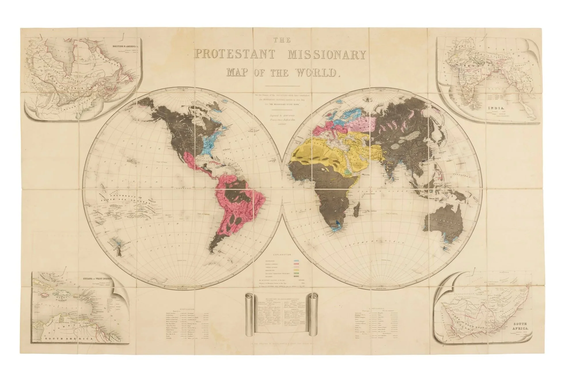
A large and striking 'missionary map' – a powerful example of ‘persuasive cartography’.
Colour is used to great effect here, with utterly undifferentiated ‘heathen’ regions portrayed in black, akin to the use of black for uncharted territory in Quin’s similarly ideological Historical Atlas (which we offer in this ViaLibri showcase), also issued by Seeley and Burnside.
The other religions depicted are Protestantism (blue), Roman Catholicism (scarlet), ‘Greek Church’ (pink), ‘Mahometan’ (yellow), and, remarkably, ‘Decayed Christian Churches’ (green). The map was issued as a counterpart to the The Missionary Guide Book (not included here), which features a much simplified and uncoloured version of the map as its frontispiece. Yet this is clearly a virtuosic stand-alone cartographic performance, intended to show the present ‘limited’ reach of Protestantism and to act as an encouragement to further missionary activity, perhaps especially in the ‘unconquered’ lands.